Tonight’s Thoughts
 It’s been a long few days, friends, as Hurricane Francine has kept many of us along the Gulf Coast glued to the spaghetti plots and models, watching them shift back and forth, left and right—like a windshield wiper you can’t turn off. That kind of uncertainty wears you down. It drains your energy, leaves you anxious, and makes you storm-weary. But despite the constant back and forth, there’s comfort in knowing we’ve faced this before. And in the next 24 hours, this will all be behind us.
By this point, most of your storm preparations should be done. While I don’t feel there’s a need to evacuate for this storm unless your local experts say otherwise, follow their advice if you’ve been instructed to leave. I’ve noticed that gas is getting harder to find, but there are still some stations with fuel if you check around. If you can’t find any, you may have to wait until the storm passes for restocking.
Now, it’s easy to think a smaller storm won’t do much damage. After all, this isn’t a major hurricane. But don’t let that lull you into complacency. Even a smaller storm can pack a punch. We’ve seen storms like this bring widespread flooding, power outages, and wind damage. So, don’t let your guard down just because it isn’t a Category 4. I wrote a day or so ago, about the sky falling, well now it probably will.
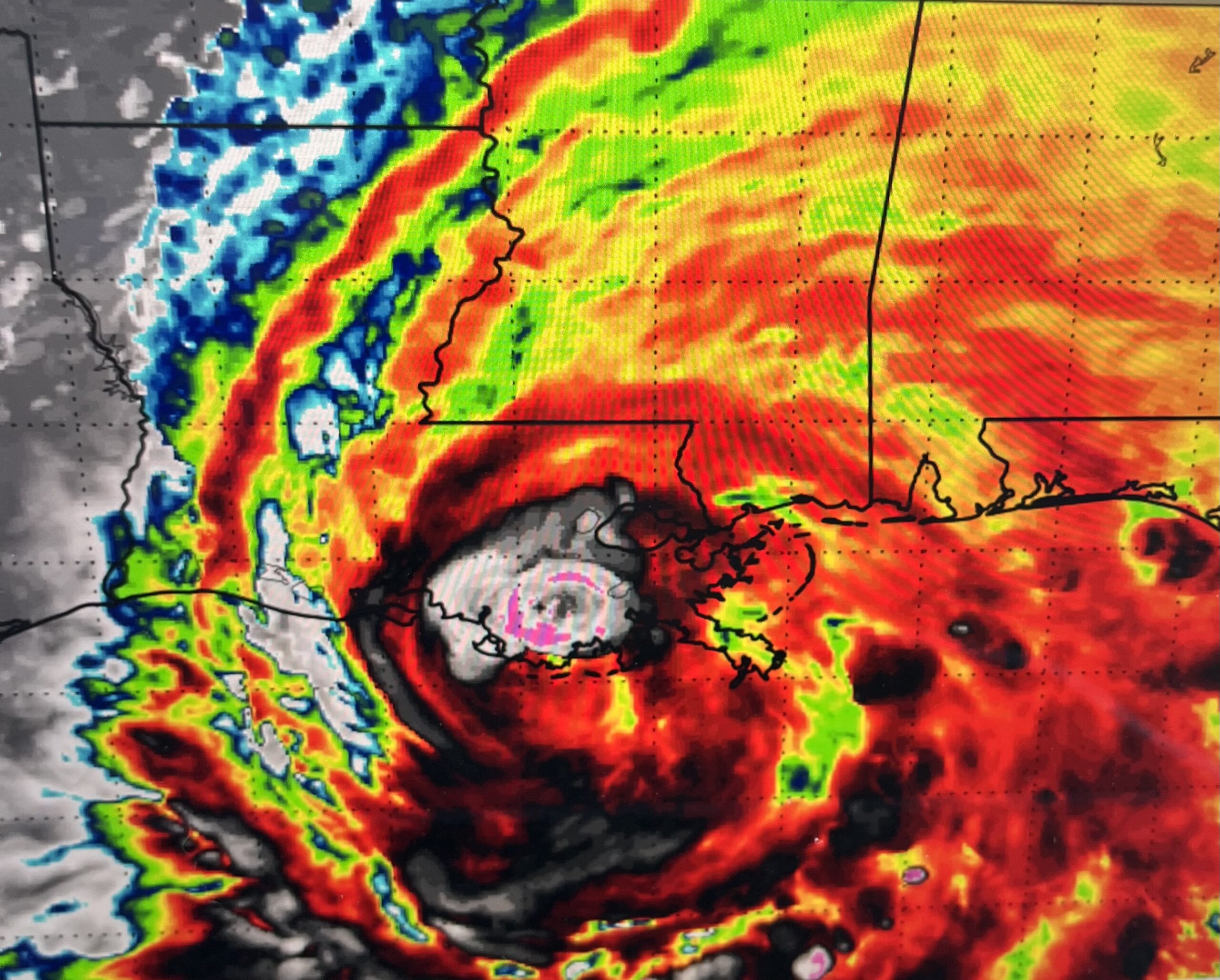
Tonight, Hurricane Francine is strengthening, and by morning, we’ll likely see that process continue. Earlier today, Francine stayed stagnant with winds around 65 mph, but recently there’s been a significant blowup of convection near the center, signaling it’s now strengthening. While the west side of the storm still looks a bit sheared, the increased activity near the core is a sign that Francine could become more organized overnight. Whether it’s a 5 or 10 mph increase in wind speeds won’t change the fact that we’re still looking at strong winds, heavy rain, and coastal flooding.
What’s more concerning is how a 5 to 10-mile shift in the storm’s track could drastically change its impact. One small shift can mean the difference between severe storm surge and minimal flooding. Coastal areas, in particular, need to stay vigilant—just a slight change in direction can alter who gets hit the hardest. That’s why it’s crucial to stay prepared, regardless of where the forecast places the center of the storm.
For coastal residents, the surge will come in fast. You’ve been through this before and know when it’s time to leave or stay put. Trust your instincts and the advice of local weather authorities. Don’t let the fact that Francine isn’t a major hurricane fool you into underestimating its potential. We’ve seen the damage smaller storms can cause, and it’s the ones you don’t take seriously that can catch you off guard.
And hey, if you’ve already burned through half your hurricane snacks while binge-watching the news, don’t forget to hop on Facebook and mark yourself safe from your own pantry!
Let’s all stay smart and safe. Take the necessary precautions and look out for each other. We’ve weathered worse storms, and we’ll weather this one too. Let’s do everything we can to ensure there’s no loss of life this time.
Ralph